Recreational Boating Information for the Northwest
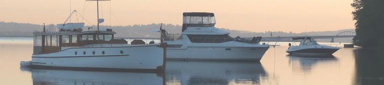

Local Bridge Navigation and Information
Note: All clearance figures are at mean high lake water level or tide .
Linked to Google Maps and NOAA Charts
- Location: Northwest Bainbridge Island Vessel Clearance: 75 feet
- Location: Seattle, Ship Canal, Salmon Bay Vessel Clearance: 46 feet at center
- Location: Seattle, Duwamish Waterway, Puget Sound Vessel Clearance: 39 feet
- Location: Portage Channel near Port Hadlock Vessel Clearance: 58 feet
- Fremont Bridge Location: Seattle, Lake Union / Ship Canal next to Aurora Bridge Vessel Clearance: 30 feet
- Hood Canal | William A. Bugge Bridge Location: North Hood Canal | Request opening: 360.779.3233 Vessel Clearance: 31 feet West end, 50 fleet East end
- Lake Washington I-520 Floating bridge Location: Seattle, connecting Montlake to Medina Vessel Clearance: West Channel 44 feet, East Channel 70 feet
- Lake Washington I-90 Floating Bridge Location: Seattle, connecting Rainer Valley to Mercer Island Vessel Clearance: 29 feet West and East Channels
- Lake Washington East Channel I-90 Bridge Location: Mercer Island to Bellevue Vessel Clearance: 65 feet
- Manette Bridge Location: Bremerton | Port Washington Narrows Vessel Clearance: 82 feet
- Murray Morgan 11th street Vertical Lift Bridge Location: Tacoma, Foss Waterway Vessel Clearance: 60 feet lifting to 135 when up.
- Montlake Bridge SR513 Location: Seattle, Portage Bay | Montlake Cut Vessel Clearance: 46 feet
- Location: Seattle, Puget Sound at The Lock Vessel Clearance: 43 feet
- South Park 16th Ave Bridge Location, Seattle, Duwamish Waterway Vessel Clearance: 34 feet
- Snohomish River Bridge Location: Everett, Snohomish River Vessel Clearance: 35 feet
- Spokane Street Swing Bridge Location: Seattle, Duwamish Waterway, Harbor Is, Puget Sound Vessel Clearance: 55 feet
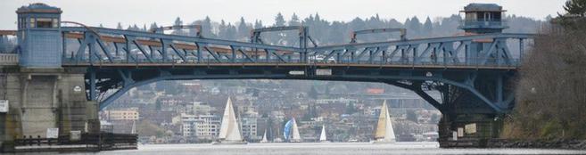
- University Bridge Location: Seattle, Portage Bay next to the I-5 bridge Vessel Clearance: 42.5 feet
- Warren Avenue Bridge Location: Bremerton | Port Washington Narrows Vessel Clearance: not available at this time
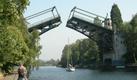
The Washington State Department of Transportation operates 17 moveable bridges on state routes.
Federal Law gives marine traffic the right-of-way over vehicular traffic. WSDOT works with the US Coast Guard to create reasonable restrictions on marine openings (for vessels under 5,000 gross tons) during peak travel times to ease congestion for drivers when possible.
Below we've listed bridge information for the Puget Sound area along with Lake Union and Lake Washington. We have also listed any rail bridges.
Restrictions on marine openings for bridges over Lake Union
and the ship canals.
Rule of thumb: From May 1 to August 31, drawbridge openings for marine traffic are restricted on weekdays between 7 a.m. and 9 a.m. and between 3:30 p.m. and 6:30 p.m. Between 12:30 to 3:30 p.m. and from 6 to 6:30 p.m., openings are limited to the hour and half hour.
From September 1 to April 30, drawbridge openings for marine traffic are restricted on weekdays between 7 a.m. and 10 a.m. and between 3:30 p.m. and 7 p.m. However, the drawspan may be opened anytime on the weekend or on federal holidays.
Request an opening: Call the bridge tender at 206.720.3048 or VHF CH. #13. Average opening time: 4 minutes, traffic delays may be longer.
When requesting a bridge opening from 7:00 AM - 11:00 PM vessels should contact the bridge by radio (marine Band ch 13) or use a whistle signal - one long, one short. Pleasure vessels are requested by the Coast Guard to use a whistle signal from 7:00 AM to dusk.
During closed periods, bridge openings will not be made unless a vessel is 1,000 gross tons or more, or is towing a vessel exceeding 1,000 gross tons (Federal Regulation).
One bridge operator (the Call-out Bridge Operator) is responsible for the three Ship Canal bridges between 11:00 p.m. and 7:00 a.m. Vessels are required to give one hour advance notice for a bridge opening. To request an opening, vessels should call the Bridge Shop on Marine Channel 13, or by telephone at 386-4251 after 11:00 p.m. The operator will drive to the bridge at the agreed time.